
SBLN - The "Real" Survey Results

I have already written about my attempts to get sight of the comments submitted as part of the South Bristol Liveable Neighbourhood (SBLN) engagement survey.
I did manage to get hold of some of the comments but I am still waiting for BCC to provide the rest of them. (I have been waiting for almost 3 months so far).
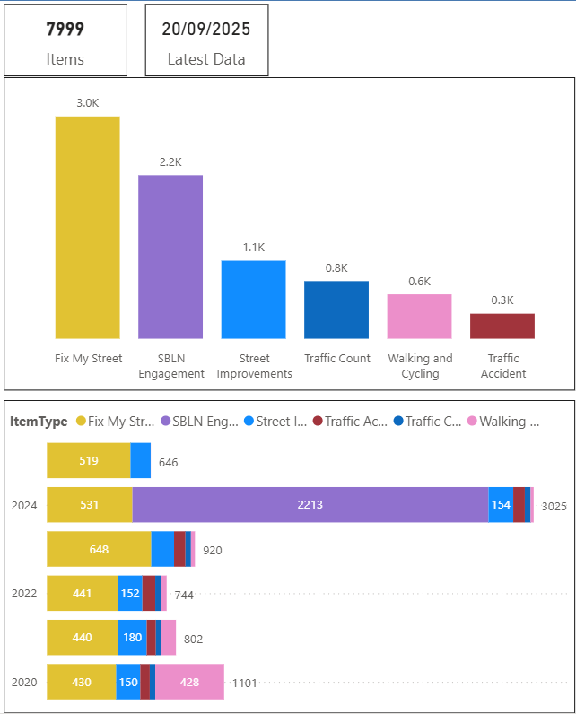
Instead of twiddling my thumbs I have looked for other sources of Resident Feedback and data that might help us understand what type of improvements people want:
- Street Improvement Suggestions
- Walking and Cycling Suggestions
- Traffic Accident Reports
- Some categories of FixMyStreet Reports
- Daily Average Traffic Counts
Here is the data for the Wards in the SBLN (Bedminster, Southville and Windmill Hill):
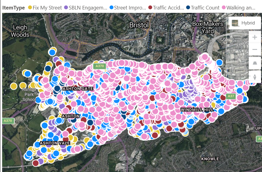
Here is the data related to some locations in the SBLN area. I have chosen locations in Southville because I live nearby and have got more "local knowledge".
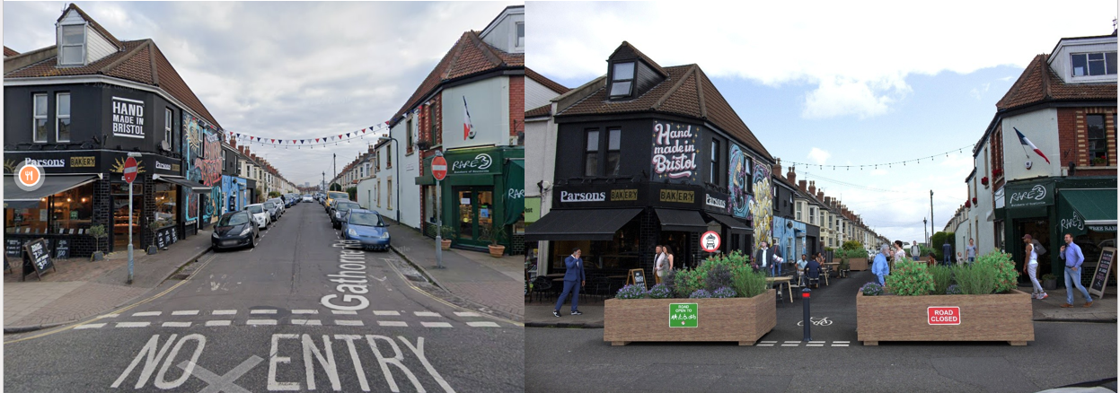
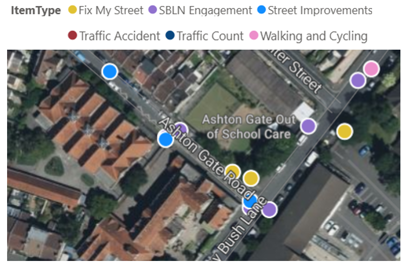
Gathorne Road
"Following feedback from the community, we propose to close the end of Gathorne Road to traffic at the North Street junction using modal filters. This would:
- make it easier to cross the road
- create spill out space for hospitality
- release space for greenery and arts and culture programming
Gathorne Road would be made two-way and double yellow lines would be installed to create a turning space for vehicles to turn around."
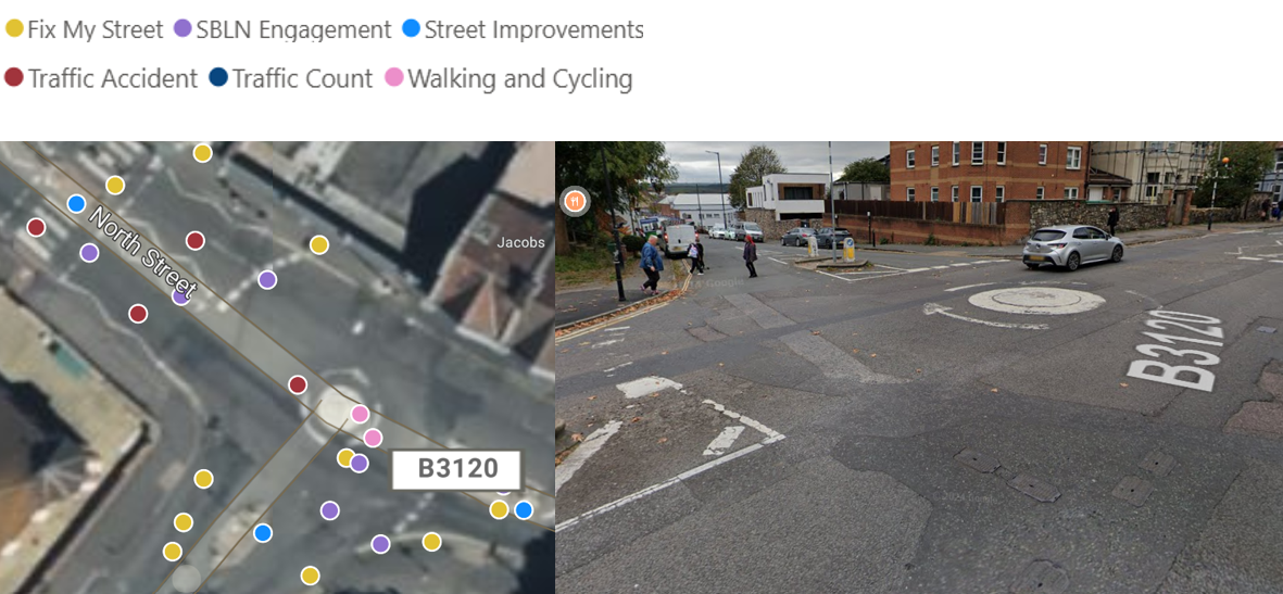
What data can we find about this location?
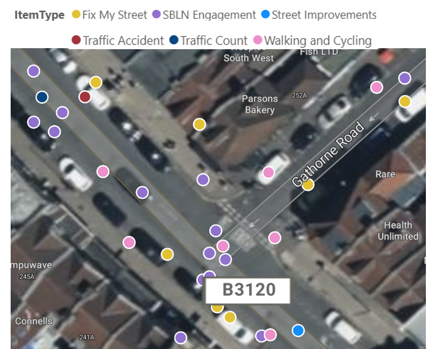
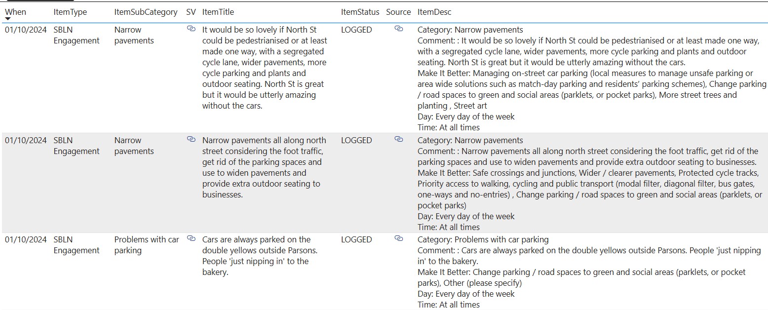
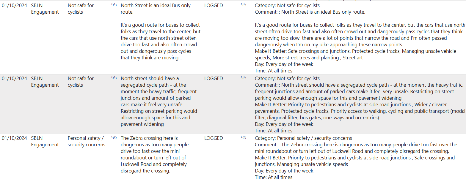
SBLN Engagement Data (incomplete)
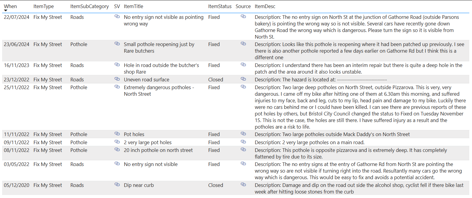
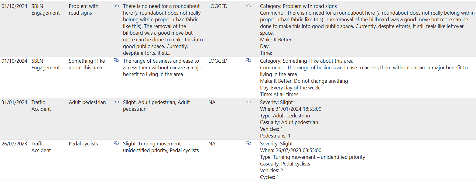
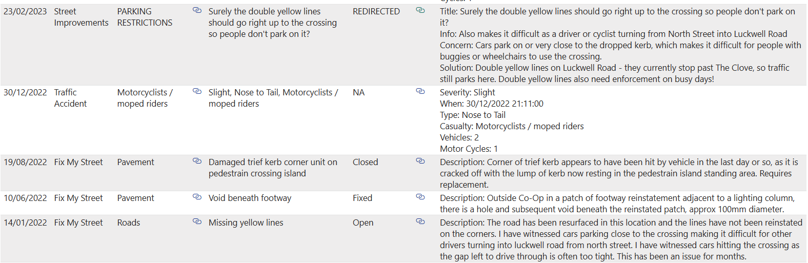
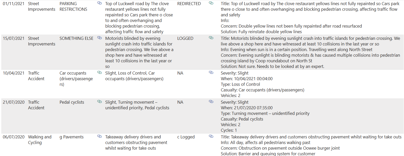
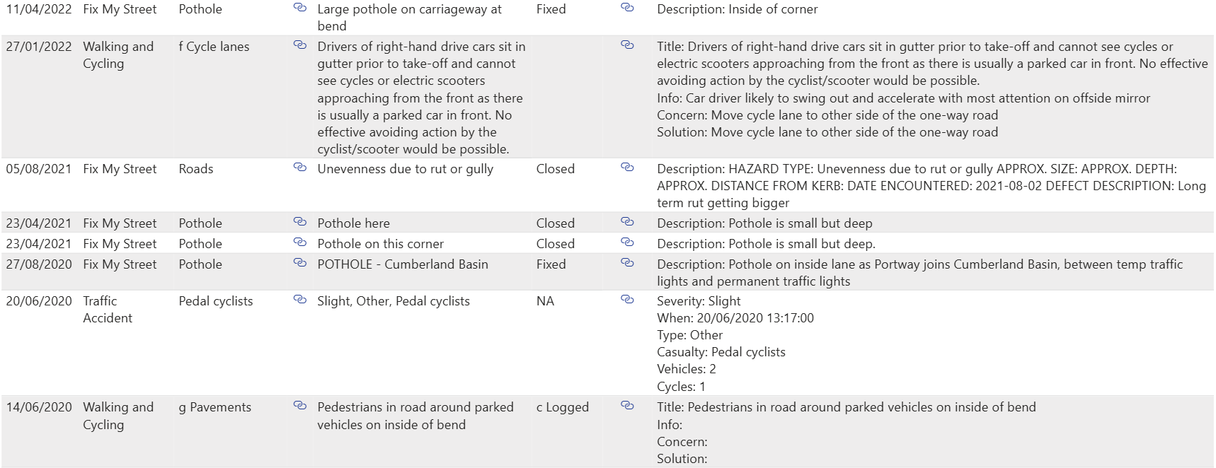
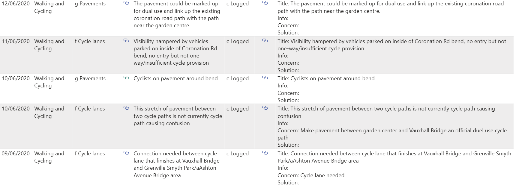
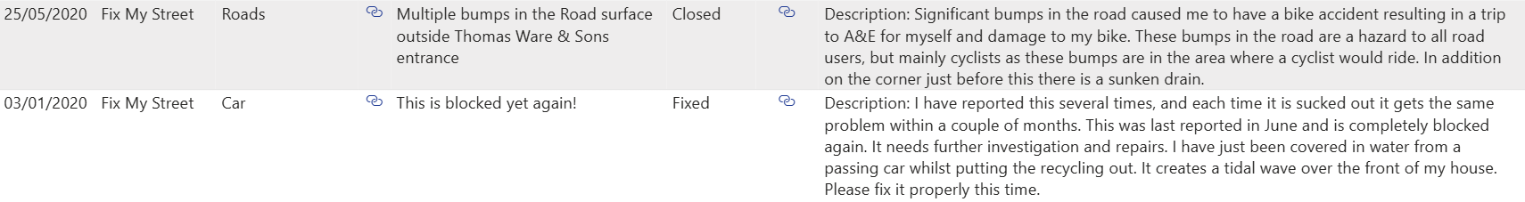
FixMyStreet
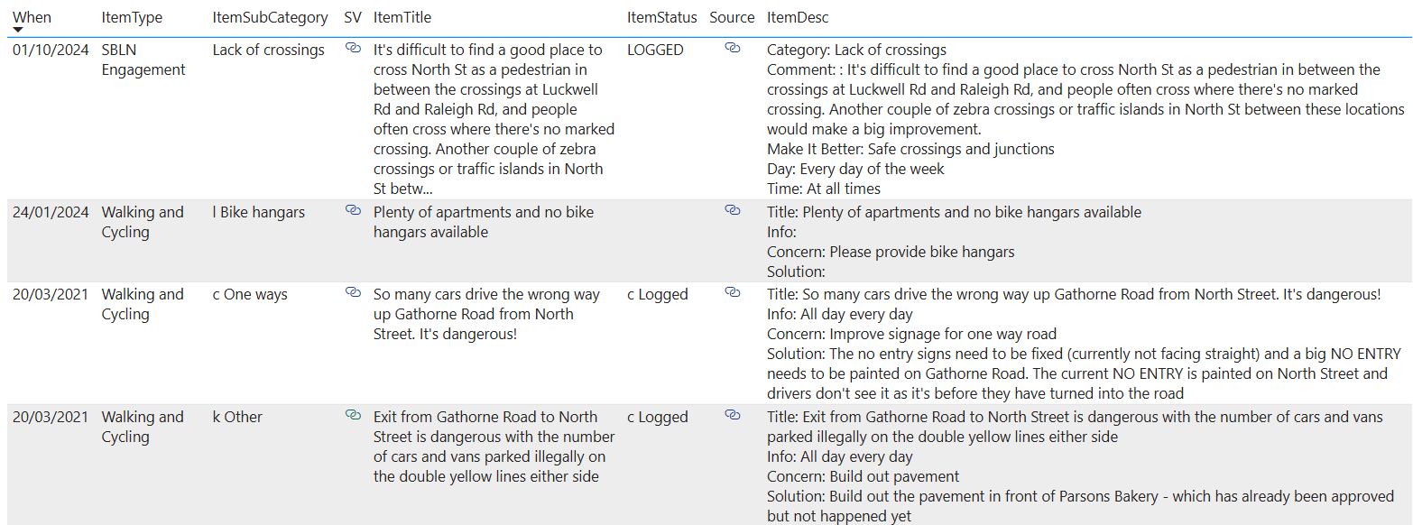
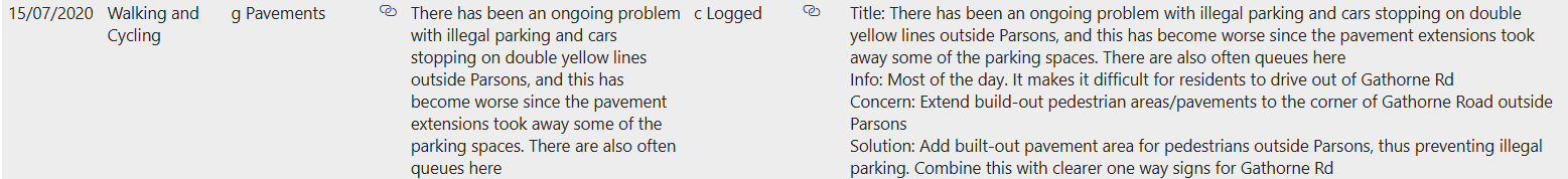
Walking and Cycling Improvements
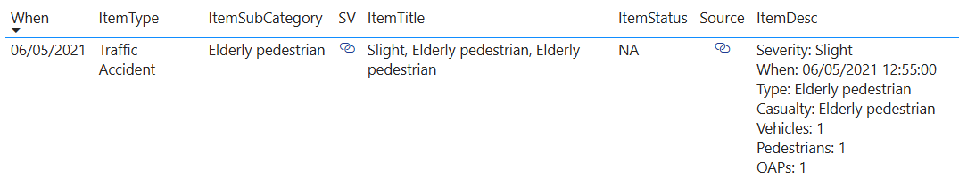
Traffic Accidents
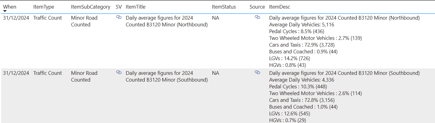
Traffic Counts
Summary
There are quite a few feedback items that would support the blocking of Gathorne Road to make it safer for pedestrians and reduce illegal parking. The only accident report was not on this junction but was further along from Parsons. Cyclists make up about 10% of the traffic (approx. 9,500 vehicles a day) and 70% is Cars and Taxis.
Many of the people who park in this area are shoppers "popping into Parsons", or delivery vans making deliveries to nearby shops. What will these drivers do? Will they stop using local shops, park in Aldi's and walk up the road, or will they park illegally at the junctions either side of Gathorne Road? What do the nearby businesses think?
And what about the residents of Gathorne Road? Will they be happy about the more difficult parking situation? Will an additional Cycle Hangar be installed at this end of the road?
Blocking this junction could make North Street more dangerous for pedestrians to cross, as cars turning into (and out of this junction) will naturally cause breaks in the traffic flow and slow down traffic on North Street.
What about the suggestions about putting a new pedestrian crossing in at this point in North Street?
Ashton Gate School
"We propose modal filters to close the road outside Ashton Gate School on Ashton Gate Terrace, from the junction with Greenway Bush Lane up to the first row of housing. This would create a safer, calmer entry to the school and allow school children to access their play and sports area more safely. Vehicles travelling from Ashton Gate Terrace to Greenway Bush Lane would need to exit onto North Street and re-enter Greenway Bush Lane."

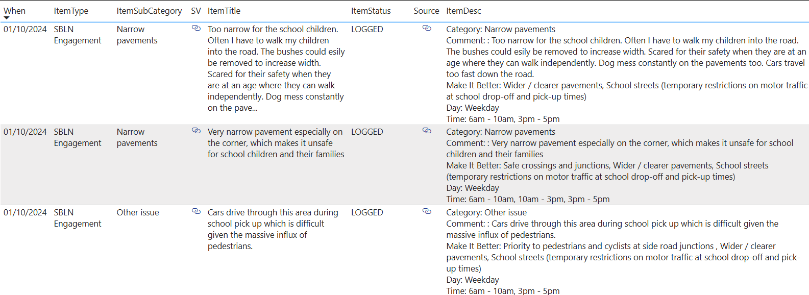
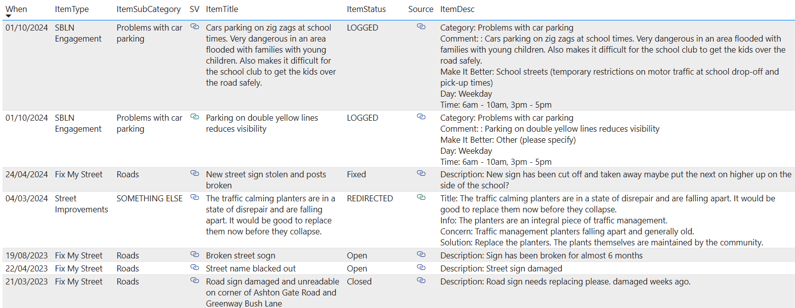

Summary
There is no Traffic Count data available and no Traffic Accidents have been reported in this location.
The main issue reported is with the safety of parents and children walking to and from school. The final few meters of the walking journey would be made safer by the closure of this road entrance.
But the main danger seems to be caused by nearby narrow pavements and a minority of inconsiderate driving parents who park dangerously and cause a spike in traffic at pick/up and drop/off times. These parents will just park on Greenway Bush Lane instead, and the traffic spikes are unlikely to change. The proposed closure might actually make it more dangerous for pedestrians on Greenway Bush Lane. Or they might still drive up Ashton Gate Road from the other direction and then try a dangerous turning maneuver to drive out.
What about the residents of Ashton Gate Road? Will they be happy to lose access and parking spaces in order to provide better pedestrian access for a few hours a week during term time?
North Street Roundabout (by the Co-Op)
No SBLN improvements are proposed for this location.
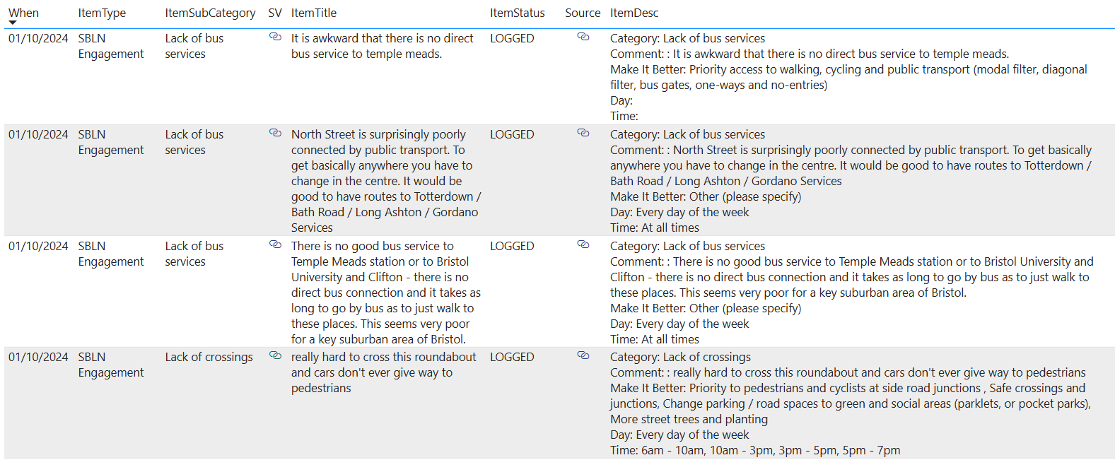

Summary
According to Reported Accident Data this is the most dangerous location in the area.
No improvements have been proposed here, and it will remain a dangerous location for pedestrians and cyclists.
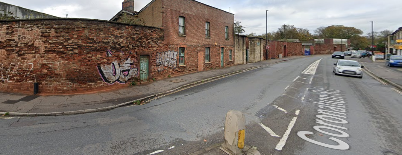
Coronation Road (at the Tannery end)
No SBLN improvements are proposed for this location.
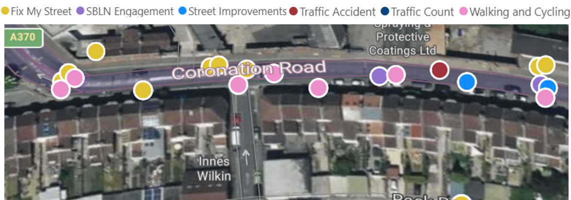
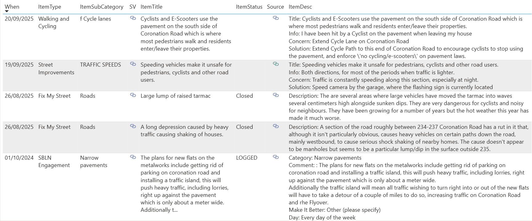
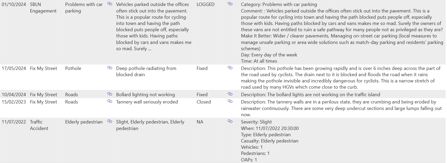
Summary
It seems like a "no brainer" to put in a proper cycle lane at this end of Coronation Road. Perhaps a speed camera could also be installed to reduce speeding along this stretch of road.
The nearby "Paynes Yard" development has been delayed for years, and is likely to be delayed for another 5 years at least due to the dangerous condition of the New Cut at this point. The Council should improve cycling safety at this location and also put in measure to reduce speeding now. People have been asking for these improvements for years and we deserve better for cyclists and pedestrians (and perhaps they could fix the potholes as well).
Comments ()