
Is Frayne Road a lorry rat run?
Bristol City Council have responded to challenges about the evidence for "rat run" problems in Southville by publishing a lot of the data that they say backs up their claims that there are problems with motorists using Southville side streets as "rat runs".
- Independent Analysis of SBLN Survey Data Detects NO Evidence of Cross-Zone Traffic (3 Apr 2026)
- SBLN: The Fundamental Lie (27 Mar 2026)
- Bristol's Road Tax It Forgot To Mention (1 May 2026)
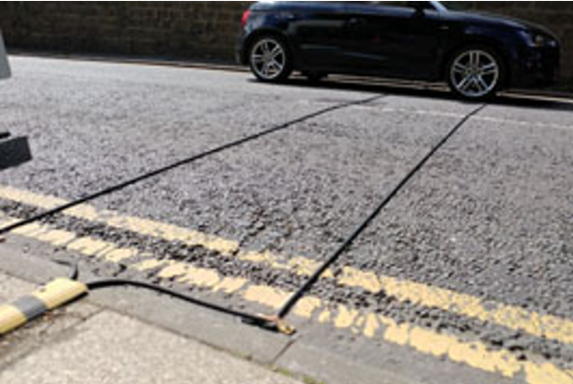
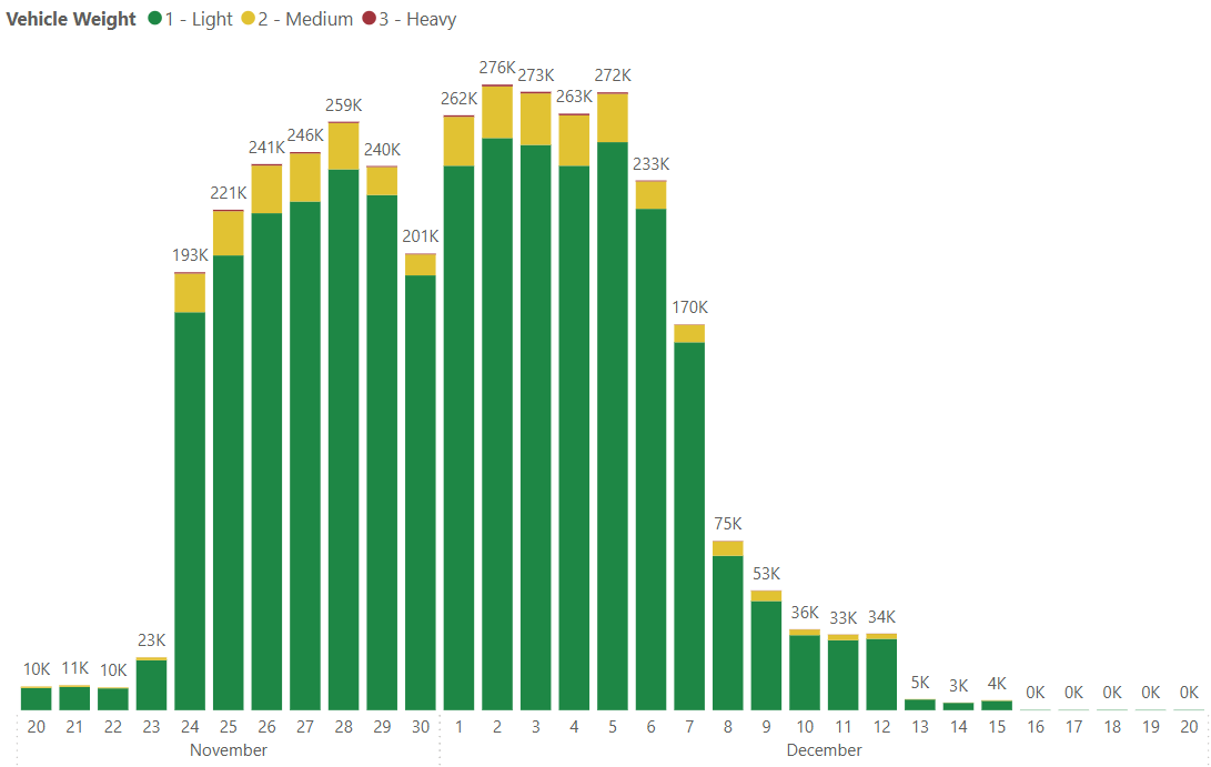
This week BCC published data on the monitoring that they carried out in Nov/Dec 2025. The data comes from Automated Traffic Counters (ATC) that appeared in the area late last year. These ATCs are usually rubber tubes that are laid across the road.
They can detect:
- Vehicle count
- Direction of travel
- Speed
- Vehicle class, such as car, van, bus, HGV, or motorcycle
- Axle count and axle spacing
- Time of day traffic patterns
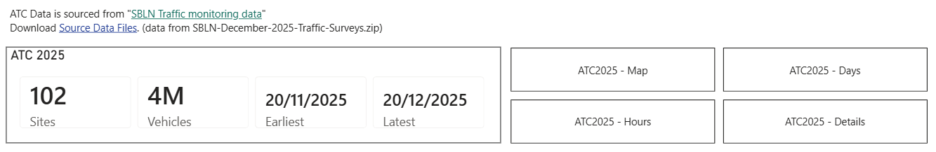
The Council recorded data from 102 sites for 2 weeks in Nov/Dec 2025.
The ATC monitoring data for Nov/Dec 2025 was published in 90 spreadsheets containing millions of pieces of data.
This is a screenshot of one small part of one of the 90 spreadsheets of data.
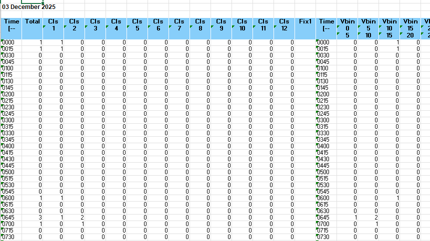
You can download the data yourself using this link.
As no-one in their right mind would actually try and read the 90 spreadsheets to try and make sense of this data, I have spent a few hours building some reports from the spreadsheets so that mere mortals can actually have some chance of understanding it.
These are the 102 locations where ATC monitoring was carried out.

They didn't record data from all sites in the same 2 week period, which is why there are smaller totals at the beginning and end of the monitoring period.
In order to illustrate some of the apparent problems with the data I will look at one site (ATC Site 2) on Frayne Road.
Frayne Road is only open one way to motor traffic, but cyclists can travel in both directions.
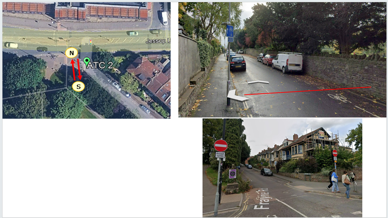
This means that there should not be any motor traffic recorded in the South to North direction.
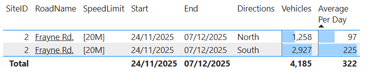
But when you look at the monitoring data you can see that 1,258 vehicles (97 per day) are recorded as traversing Frayne Road from South to North.
The type of vehicles are broken down in the data and one of the classes is "Bicycle/Motorcycle". So could these be Bicycles which are allowed to travel in that direction?
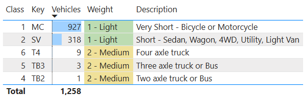
Many of the 927 are likely to be Bicycles, but some of them could be Motorcycles.
But that still leaves 331 Cars and Lorries that are recorded as travelling the wrong way up Frayne Road over the 2 week period.
Are we really expected to believe that this many vehicles are driving the wrong way along Frayne Road?
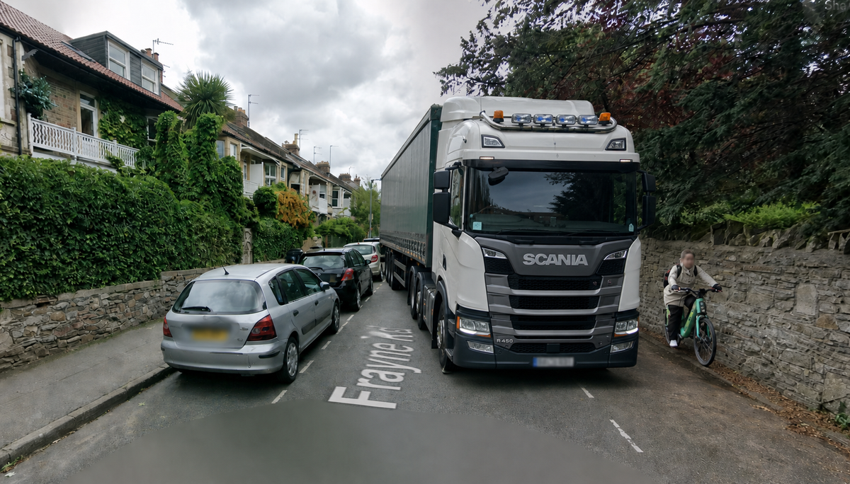
(Computer generated image of a lorry on Frayne Road)

When you look at the North to South direction (legal for motor vehicles), you can see that a six axel articulated lorry is supposed to have driven down Frayne Road.
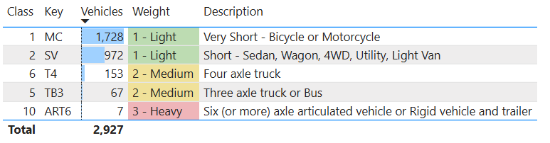
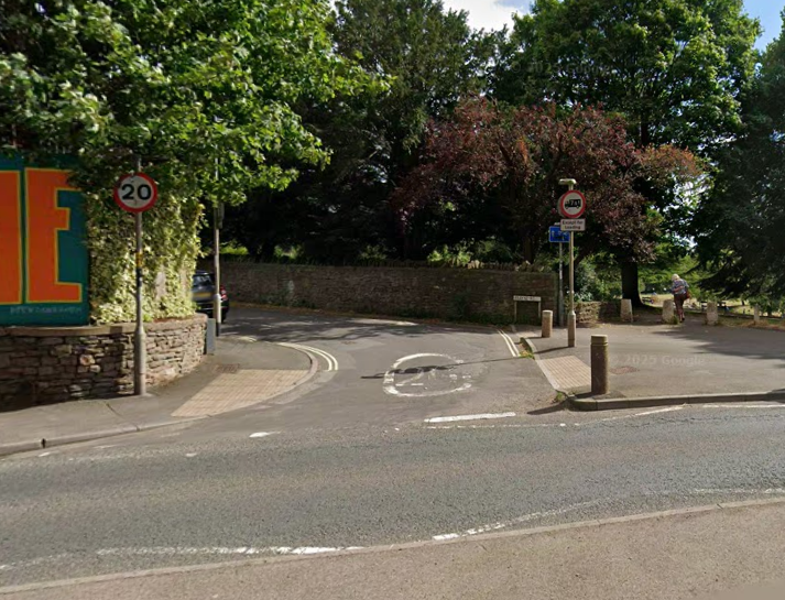
If you look at the Frayne Road Junction, you can see that it would be very difficult (if not impossible) for an articulated lorry to get onto Frayne Road.
Either the ATC monitoring data shows that Frayne Road has a problem with heavy vehicles travelling along it, and also with many motor vehicles driving the wrong way along the road. Or is shows that there are some problems with the data that has been collected.
It is also concerning that Bicycles are included in the monitoring data as it is not valid for bicycles journeys to be used as evidence of "rat running".
I will keep on digging into the data and let you know if I find any other interesting facts.
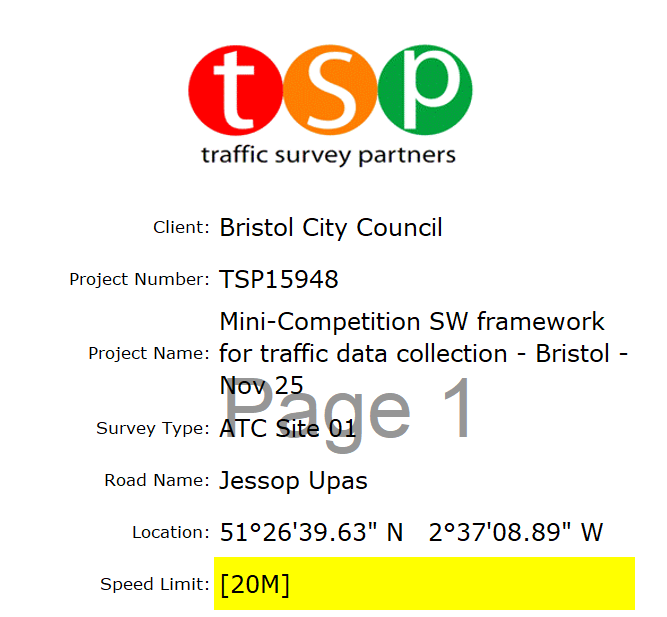
Note added on 02/05/2026
The company that collected the data seem to think that Jessop Underpass (end of Coronation Rd) has a 20mph speed limit, when it is actually 30mph
Comments ()